 BGS Data Catalogue
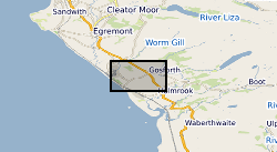
Core analysis
Type of resources
Topics
Keywords
Contact for the resource
Provided by
Years
Formats
Representation types
Update frequencies
Scale
-
The paper archives comprise a set of the factual and interpretative reports that document the investigations carried out by Nirex (Nuclear Industry Radioactive Waste Executive) and its contractors. In total there are in excess of 2,250 individual volumes. It is the availability of this paper archive of results and interpretation that makes the Nirex geological archives of rock cores and samples unique. The ownership of NIREX (Nuclear Industry Radioactive Waste Executive) was transferred from the nuclear industry to the UK Government departments DEFRA and DTI in April 2005, and then to the UK's Nuclear Decommissioning Authority (NDA) in November 2006.
-
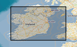
Due to differential loading of ice on Britain and Ireland the glacial isostatic adjustment (GIA) response and therefore sea-level record will vary with distance from the centre of the British Irish Ice Sheet. GIA models are tested against geological observations, however there is a paucity of observations below -10m depth and the lateglacial period when the BIIS retreated leading to a rapid response of both sea-level and GIA. The aim of the project was to use geophysical data, ground truthed by core material, to find evidence of lateglacial sea-level minima in the Irish and Celtic Sea to refine these GIA models. Cruise log and digital copies of the core information (location, water depth, core length) taken onboard the research cruise CE12008 on the RV Celtic Explorer. A GeoReseource 6m vibrocorer was used to collect sediment samples. Cores where taken at multiple sites and from southern and eastern Ireland: Bantry Bay, Dunmanus Bay, Waterford,Offshore County Louth and Dundalk Bay, offshore Isle of Man; offshore Wales: Cardingan Bay; and offshore Northern Ireland: Kilkeel and Dundrum Bay, Belfast Lough.
-

This dataset contains the collated wireline logs, stratigraphy and core analysis of the three boreholes drill as part of the publicly funded Rapid Global Geological Events Project (RGGE) which ran between 1995-1998. The aim of the RGGE project was to identify the effects of climatic changes on modern sediments. The project focused on the Kimmeridge Clay due to its unbroken sequence of fossiliferous marine mudstones. These mudstones have compositional variations in organic content, minerology, fauna and clay content which reflect changes in both the climate and sea level. Over the course of the project the entire sequence of the Kimmeridge Clay was cored across three boreholes, two at Swanworth Quarry and one at Metherhills.